
Hiking holiday
in the Zillertal
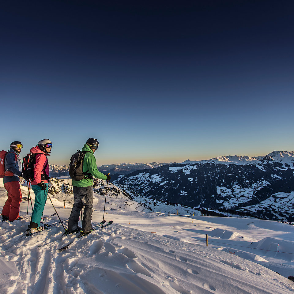
Climbing & Hiking
Would you like to head up to the summit of the Reither Kogel at 1,335 meters above sea level? How about a panoramic hiking trail that begins directly at the hotel? Or prefer an easy route that leads right past the Schlitters natural swimming lake? Hiking in Zillertal is characterized by alpine nature and boundless variety! Who comes to the mountains, has to clamber as well. The oldest kind of sports in the Zillertal is enjoyable on climbing routes, climbing crags and modern indoor facilities.
We gladly advise you about the best offers in the surrounding at the hotel in detail.
Spitzerköpfl
- Bruck – Spitzerköpfl – Fiechter-Kapelle – Bruck
- Walking time: approx. 2 hours
The hiking path begins right behind the Sonnleiten (above Buachebn) in numerous, steep curves to the Spitzerköpfl (809m) – you can continue your hike to the Reither Kogel or return via the Fiechterkapelle.
Reither Kogel (1337m)
- Bruck – Reither Kogel
- Walking time: approx. 2 hours
Go uphill south of the Dorfwirt to the edge of the forest. Now head north (left) to the Spitzerköpfl, a rocky pinnacle with an enclosed grassy field. Magnificent view towards the south of Zillertal and towards the north of the Karwendel and Sonnwend mountains. On path B3 you will continue to the Reither Kogel. For a loop trail (ca. 4 1/2 hrs.) you must take the downhill trail to Reith (path R17 or R29) and then return via R6 to St. Gertraudi – via St. Gertraudi on the street back to Bruck.
Klausegg
- Bruck – Klausegg – Bruck
- Walking time: approx. 3/4 hour
From town you will take a slightly uphill path, through the forest, past the drop of the Spitzerköpfel, to the Klausegg.
The return path is at first somewhat steeper uphill in the Zillertal. Then at the houses you take the driveway to the street (nightshade) and follow this back to town.
Säulingerhof - Hart
- Bruck – Säulingerhof – Hart – Bruck
- Walking time: approx. 3 hours
Uphill south of Bruck and turn in the direction of Gasthof Säulingerhof –the road with little traffic leads lightly uphill to Gasthof Säulingerhof (ca. 1 hr.) – from there, the path runs smoothly to the Marienkapelle (magnificent view of the Rofan mountains). Past the Marienkapelle, the path branches off downhill in the direction of Oberhart – the path leads through forest and fields along the rosary stations to the parish church in Oberhart – from Oberhart it's only a short distance to Niederhart – from Niederhart go in the direction of Gasthof Neuhäusl and return to Bruck.
Wiedersberger Horn (2127m)
- GH Steiner – Wiedersberger Horn
- Walking time: approx. 2 3/4 hours
From Gasthof Steinerhof the path goes lightly uphill to Bichlhof – Niederaigen.
Shortly after, the climb will take you to the Luderstein (1839m) - via the Höhengrad you continue to the Wiedersberger Horn. The descent is via AV – path 722 to Hart.


Maria Brettfall - Rotholz – Strass
- Strass - Maria Brettfall - Ellerboden - Rotholz - Strass - Bruck
- Walking time: approx. 2 hours
From Strass you can reach the pilgrimage church of Maria Brettfall in ca. 20 - 30 min. Up there, you can take a short rest at the snack station.
You will then continue in the direction of Ellerboden (ca. 5 min) and from there in the direction of Rotholz (for a little ways the path goes downhill) ca. 20 - 30 min. From Rotholz, you will return to Strass via the beautiful Linden Allee in ca. 20 min.


Waterfall in Schlitters
- Wildbachklamm to the waterfall
- Walking time: approx. 45 minutes from Schlitters
Along the Öxelbach in the Wildbachklamm gorge to the waterfall.
Circular hike Schlitters
- Hotel Sonnleiten - St. Gertraudi - Reith im Alpbachtal - Kerschbaumer Sattel - Hotel Sonnleiten
- Walking time: 3 hours
Start in a northwest direction to the Landhaus on the main road to St. Gertraudi, where you turn right and after ca. 1 km reach Reith in the Alpbach valley. You will go a short ways downhill and after Gasthof Waldschmiede turn right. Go along the street to the Kerschbaum saddle and via Steinerhof, Säulingerhof, Pöltenwirt, and Imming you will again reach the starting point.
Uderns - Schleierwasserfall
- Hotel Sonnleiten - Gasthaus Almdiele - Vogellehrpfad
- Walking time: approx. 40 minutes
PATH U11: This hike is a true natural beauty and will take you to the 81 m high Schleier waterfall in the middle of the forest. This magnificent waterfall is reachable via the Zillerbrücke bridge and Haselbach on a romantic hiking path.
Hiking tour Spieljochbahn – Hochfügen
- Spieljochbahn - Geolsalm - Schellenbergalm - Hochfügen
- Walking time: approx. 5 hours
Take the Spieljochbahn lift to the Spieljoch - from there the almost flat path goes ca. 200 m below the summit station into the valley through rhododendrons to the Geolsalm and continues in the direction of Gartalm-Niederleger to the Schellenbergalm. After ca. 200 m go in the direction of Hochfügen along the Hochfügener Straße, and then go left in the direction of Pflanzgarten via the Finsingbach over the Kegelalm or along the Finsingbach to Hochfügen. You can also travel to Hochfügen by bus and take hiking path 10 and 11 in the opposite direction.
Waterfall in Kaltenbach
- Sparkasse Kaltenbach - Marienkapelle - Waterfall - Kaltenbach
- Walking time: approx. 1 1/4 hours
The starting point is the savings bank. Go along the street, past the Marienkapelle, along the edge of the forest to the water basin. From there, the path leads over a few ascents to the waterfall. Continue along the path and after ca. 30 min., you will again return to Kaltenbach. Very beautiful, lightly uphill hiking path with view of the waterfall.
Riedbergkapelle in Ried
- Kirche Kaltenbach - Taxach - Riedbergkapelle - Taxach - Kirche Kaltenbach
- Walking time: approx. 1 3/4 hours
Go past the church in the direction of Kaltenbach - on hiking path no. 3 through the forest to Taxach (opportunity to cross over to Kaltenbach) - hiking path to the Riedbergkapelle - toboggan run - through the district of Taxach again back to Ried.

